
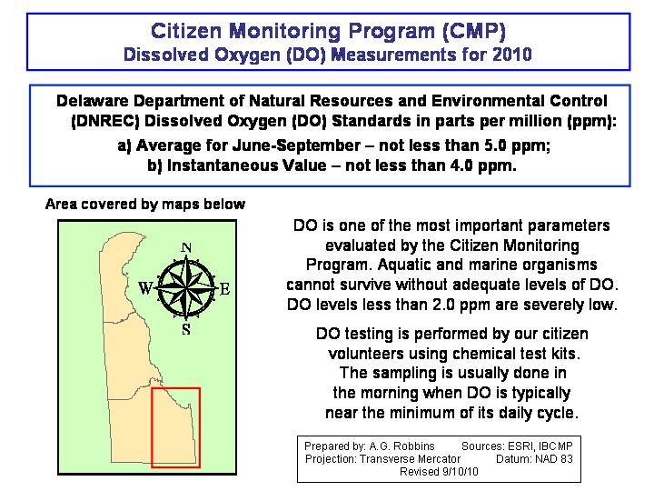
Citizen Monitoring Program
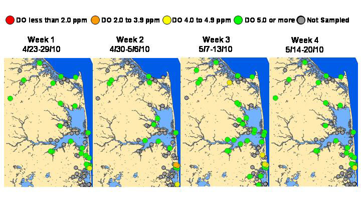
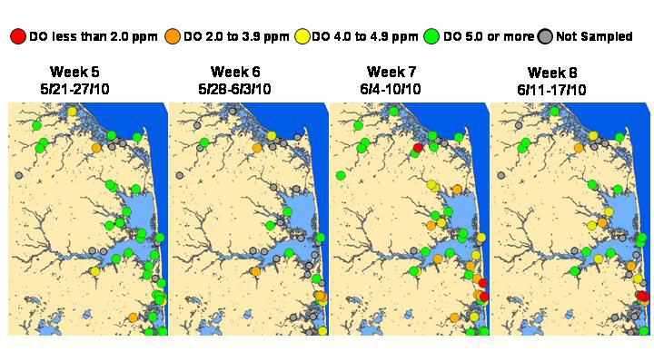
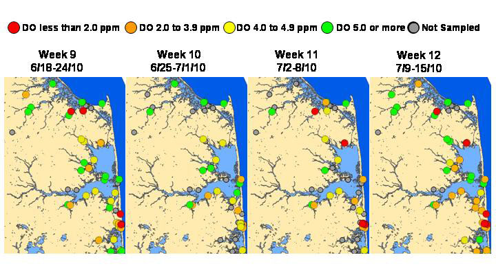
2010 Dissolved Oxygen Maps
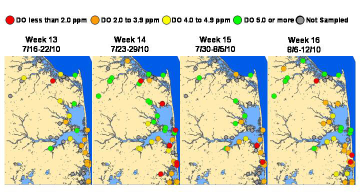
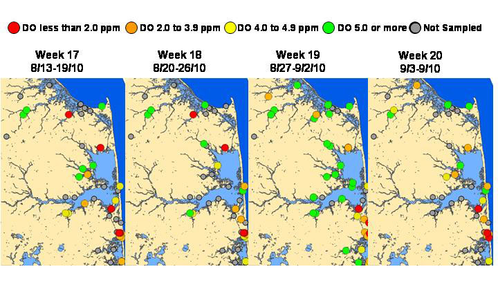
2010 Dissolved Oxygen Boat Transects
The map below is showing the Dissolved Oxygen (DO) levels collected by early morning boat transects of the bays within Google Maps. Click on the blue markers to read the DO levels for that site in July.
<div align="middle"><iframe width="425" height="350" frameborder="0" scrolling="no" marginheight="0" marginwidth="0" src="http://maps.google.com/maps/ms?hl=en&ie=UTF8&msa=0&msid=105702067799795287655.0004894fe993148aa21bd&ll=38.621308,-75.126572&spn=0.375528,0.583649&t=f&z=10&ecpose=38.34314495,-75.126572,31143.89,0,44.722,0&output=embed"></iframe></div>
View Delaware Citizen Monitoring Sites in a larger map
Copyright © 2016 University of Delaware College of Earth, Ocean, and Environment and the Delaware Sea Grant College Program | 302-645-4252