
Citizen Monitoring Program
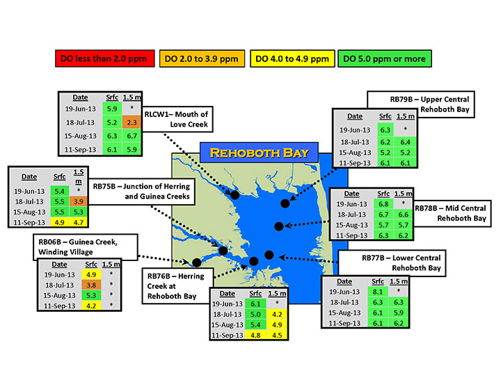
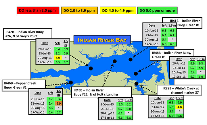
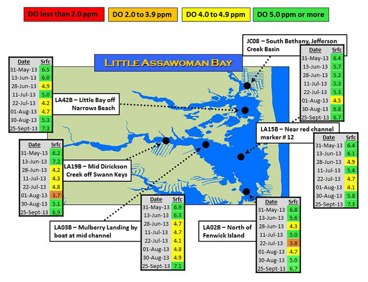
The maps below show Dissolved Oxygen (DO) levels measured during boat transects of the bays in the early morning (7:30-9:00) when DO is at or near a daily minimum. In Rehoboth and Indian River Bays, measurements were made at the surface (0.2 m) and at 1.5 m when possible. In little Assawoman Bay, water depths were not greater than 1.5 m on a dependable basis.
For each site, data tables for the season are overlain on a map for each bay. Rows in the tables are color-coded for easier interpretation of values relative to the State Standards for the minimum DO needed to fully support aquatic life; the average from June to Sept should be ≥5.0 ppm (green), and a single, instantaneous reading should be ≥4.0 ppm (yellow). In addition, values above and below a general threshold for hypoxic (low DO) conditions are shown (≥2.0 ppm-orange, >2.0 ppm-red).

Copyright © 2016 University of Delaware College of Earth, Ocean, and Environment and the Delaware Sea Grant College Program | 302-645-4252